This offer is currently only addressed to commercial customers. All prices are exclusive of goods and services tax (GST).
Intents Mobi - Road condition data with potholes & speed bumps


PRODUCT OVERVIEW
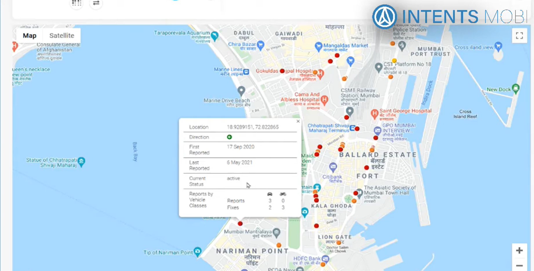
Road conditions are dynamics as they change quickly with widely varying weather and traffic conditions. They can have significant impact in the movement of goods and people and Intents Mobi's road condition data offers nearly real-time information about the same to reduce uncertainty in transportation, enable better monitoring and make the roads safer.
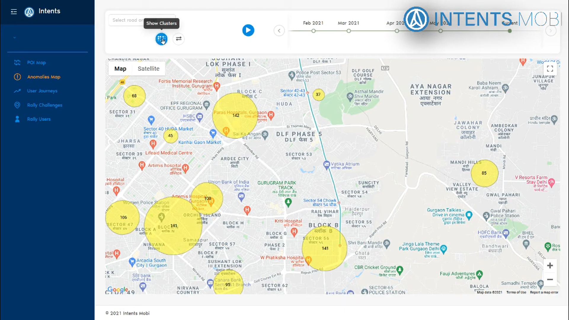
Highly accurate (>98 percent) data of potholes and speed bumps on Indian roads. Nearly 100,000 road issues are updated daily (total of added and removed, added on new potholes being created or removed on old potholes being fixed).The data is generated via smartphones and has wide geographical coverage, including remote areas and limited access neighbourhoods. It is updated in almost real-time for fixes and new issues with nearly 100K anomalies updated daily.
The data can be used for asset monitoring by civic bodies or infrastructure companies, routing for fragile good by logistics companies and road safety alerts for drivers among other uses.
Organization involved in maintenance and monitoring of roads can use the data to quantify road conditions and reduce dependence cost intensive on physical on ground surveys. Logistics companies can use it for route planning for fragile goods and for timely alerts of high risk road issues.
The data is available to access via APIs through which, on passing the lat-long of the location, the locations and intensity of all road anomalies in a 3 km radius are returned as output. It is also available as periodic update reports for pre-defined areas.
Includes historic data and trends as well for the past three years
PRODUCT FEATURES
An Overview of features
Easily scalable
Smartphone sensors are used to generate the data making it easily scalable with minimal added cost

High accuracy
Data is automatically updated with no manual intervention leading to high accuracy

Wide coverage
Easy scalability allows coverage in remote areas too which are not cost effective to cover manually
.svg)
Updated almost realtime
With nearly million contributors, the changes in road conditions are updated almost realtime
RELATED DOCUMENTS AND MEDIA
Explore more about service name by service provider